
Snow warning for southern England on Thursday
Yesterday I wrote about ten facts on this week’s cold weather, which still stand. However, as is always the case with snow in the UK, the detail changes from day to day.
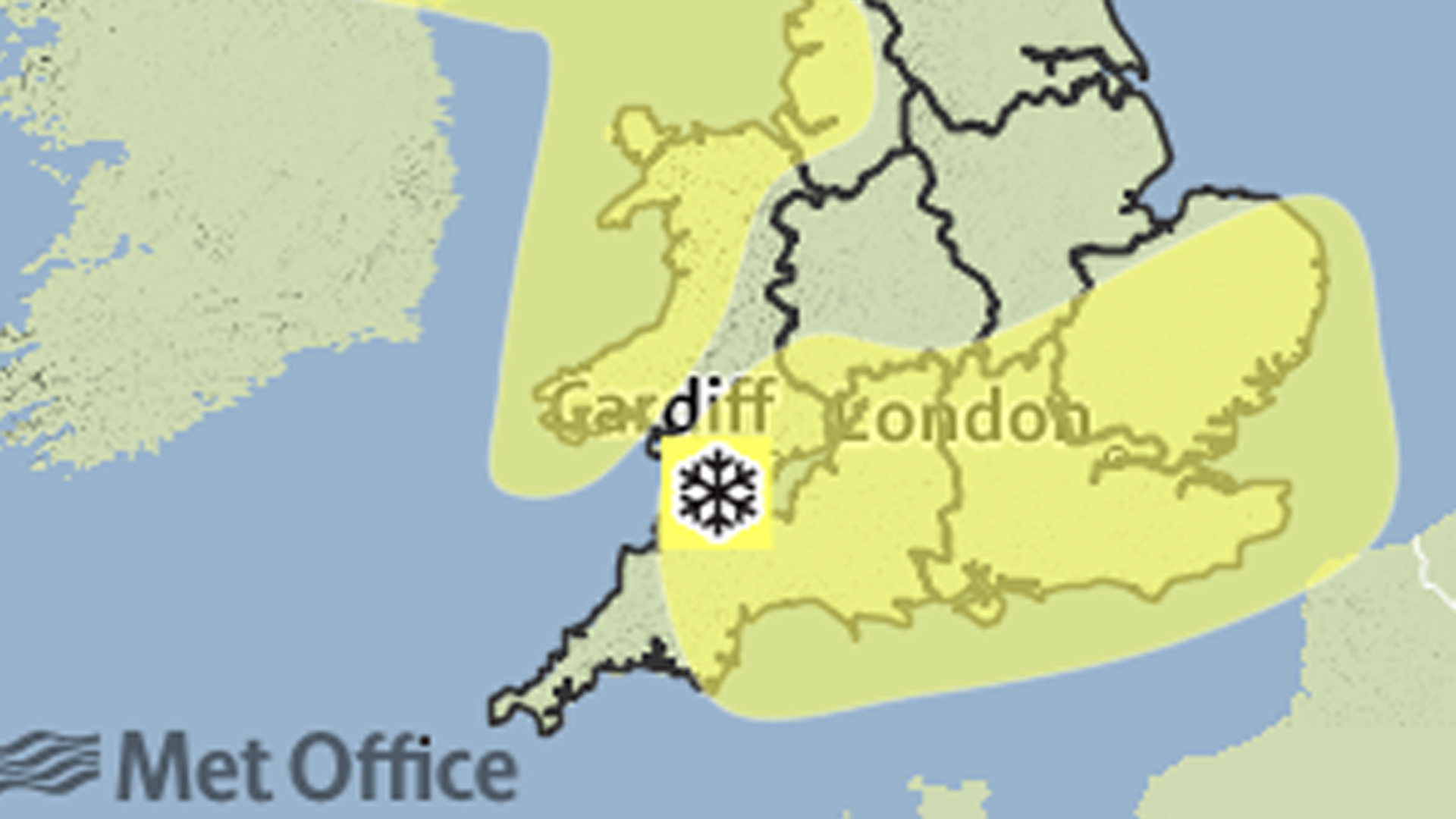
The main difference between yesterday and today’s forecast for later this week is that a yellow warning for snow has been issued for southern parts of England and Wales, in addition to the warnings for other northern and western parts of the UK.
The reason for this is that weather computer models are now suggesting that a small area of low pressure will push eastwards on Thursday.
Whilst most places will probably see rain, there is a chance that as it brushes against the cold Arctic air coming down from the north, it could turn to snow in places.
What is the chance of snow?
At the moment, the chance of snow is considered to be very low – probably around 30 per cent – which means rain is much more likely than snow for most.
Also, the greatest chance of snow will be over the hills, mountains and moors of Wales and southern England – especially as the rain starts to clear during Thursday afternoon and evening, as the colder air digs in and temperatures fall away into the night.

Even if rain does turn to snow, it will have difficulty settling because the ground will still be wet from the rain that preceded it and probably not quite cold enough to stop the snow from melting.
However, if it does snow, it is likely to be wet snow, with big, fluffy white snowflakes that can reduce visibility significantly and make for tricky travelling conditions.
Temperature and altitude important factors
The main factors influencing the chance of snow in a borderline rain/sleet/snow mix situation are temperature and altitude.
The height of a location above sea level determines the likelihood of snow. In most cases, the higher up a hill or mountain you go, the colder it gets – roughly by 1C for each 100 metres.
This is why snow is always more likely over hills and mountains than lower down. What you may be surprised to know is by how much the chance of snow increases with altitude.
If there is a 20 per cent chance of snow at sea level, this chance typically rises to 35 per cent at 100m, 60 per cent at 200m and around 75 per cent at 300m.

Wind strength and precipitation intensity also influential
If rain falls for long enough at a low temperature within a few degrees above freezing, evaporative cooling can gradually lower the temperature, resulting in it turning to snow.
This process is most effective when winds are light, because colder air from aloft descends to the surface more readily, as the air isn’t being mixed up by the wind.
The intensity of the falling precipitation is also influential. Light rain is generally less likely to turn to snow than heavier rain in this way, because less moisture is available for evaporative cooling to take place.
As you can see, getting the forecast exactly right for southern parts of England and Wales will be a challenge for us weather folk.
Nevertheless, you can get the latest five-day forecast on the Channel 4 Weather website. I’ll also be posting regular updates on Twitter – @liamdutton