
Europe floods: will the UK be affected?
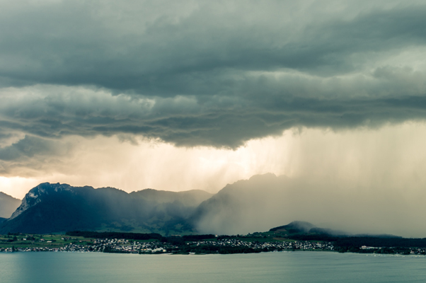
Italy, Switzerland and southern parts of France have had copious amounts of rain during the last month, leading to a series of flash floods and mudslides that have claimed lives.
The latest round of flooding hit southern Switzerland and northern Italy at the weekend, leading to landslides that have claimed the lives of four people.
Intense rain isn’t uncommon in the Mediterranean at this time of year, but during the past month, there have been a number of factors that have come together to give conditions ripe for extreme weather.
Clash of air masses
During autumn, continental Europe starts to see injections of colder air from more northerly latitudes, due to the northern hemisphere nights becoming longer than the days, leading to more energy leaving the atmosphere than entering it each day.
However, the Mediterranean’s proximity to a still relatively hot Africa means that there can still be bursts of very warm air moving up from the south.
Severe weather happens when extremes of temperature, humidity and pressure occur. So very warm air from Africa colliding in the Mediterranean with colder air from further north, provides the recipe for torrential rain and thunderstorms.
Low pressure systems that have formed from the clash of very warm and cold air have also become quite slow moving, as often there has been a very weak jet stream present, if any at all to move them through.
This leads to similar areas getting rained upon torrentially for prolonged periods of time, leading to flash floods and saturated ground.
Mountains giving extra lift
Another contributing factor to the heavy rain and flooding has been the presence of the Alps – the prominent 
Clouds form when air is forced to rise, cool and condense, before eventually producing rain. The higher the air is lifted, the colder the cloud tops will be and thus the more intense the rain.
So in effect, air being forced over the mountains has the effect of squeezing the clouds like a sponge, wringing out every last bit of rain possible.
This heavy rain then slides quickly down the steep mountain slopes, into the network of rivers that wind through countries in the area, overwhelming them with huge amounts of water and causing them to flood.
Given the persistence of heavy rain during the past month, saturated ground is unable to soak up any more water, leading to landslides when the ground gives way.
The latest forecast suggests that Monday and Tuesday will deliver more heavy rain to southern parts of Europe, before high pressure builds, leading to drier weather from midweek onwards.
Will the UK be affected?
Although the UK has been very wet during the past week, with some localised flooding and travel disruption, flooding on the scale and severity of that seen in Europe at the weekend is not expected.
In fact, this week is looking relatively drier in comparison to last week, due to high pressure over northern Europe acting as a block in the atmosphere. This will reduce the rate at which rain-bearing weather fronts move in off the Atlantic Ocean.
I’ll be keeping a close eye on the situation in the coming days and posting updates on Twitter – @liamdutton